

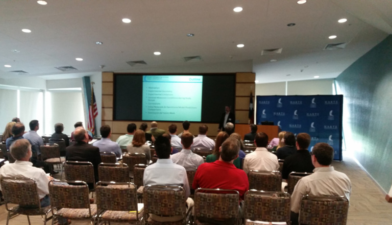
The ASBPA – Texas Chapter Symposium was held on March 20, 2015 at the Harte Research Institute for Gulf of Mexico Studies, Texas A&M University – Corpus Christi. Read about the event via this link.
Click on the presenters to view a pdf of their presentation.
Philip Blackmar
Tiffany Caudie
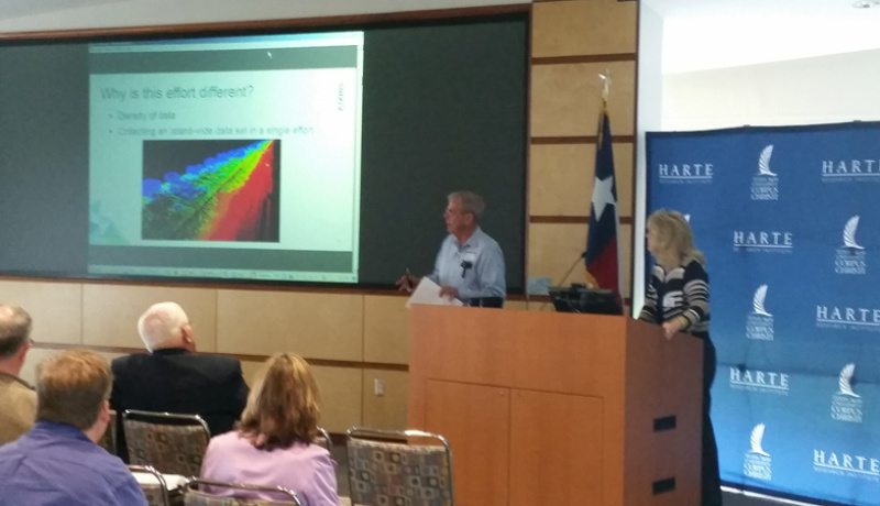
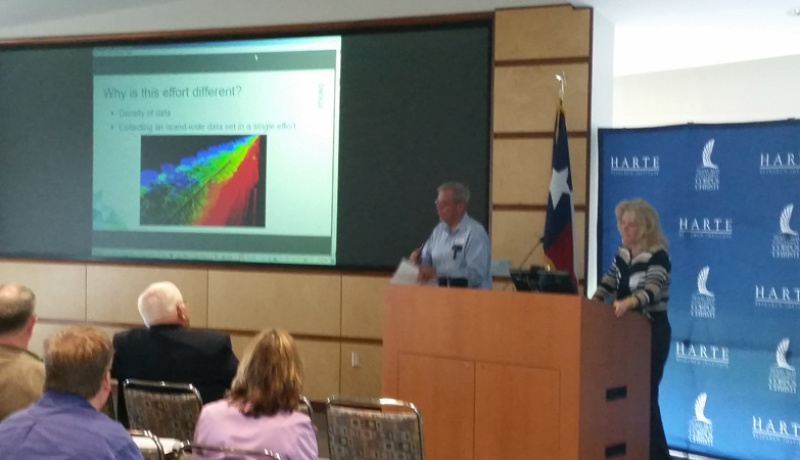
Partnering to Preserve Habitat and a Historical Landmark at Indian Point
Philip J Blackmar, HDR Engineering Inc.
555 N. Carancahua, Suite 1600, Corpus Christi, TX 73311
PHILIP.BLACKMAR@HDRINC.COM
Michael Weeks, Texas General Land Office
1700 N. Congress Ave, Austin, TX 78701
Michael.Weeks@GLO.TEXAS.GOV
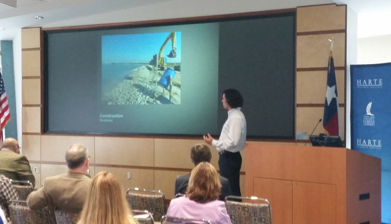
Indian Point Park is a recreational fishing pier surrounded by extensive marsh lands and lagoons on the northwest perimeter of Corpus Christi Bay along the Portland Causeway. The area provides habitat and nesting for numerous species of birds and a plethora of marine life that is all accessible to the public for birding, hiking, fishing, and much more. However, erosion has plagued the area for decades and threatens to further reduce the wetlands complex as well as damage the local infrastructure including the road and parking lot. Because the wetlands area is made up of small lagoons near the shoreline, single storm events pose a significant risk of breaching lagoon barriers and eroding the wetlands (HDR, 2012). In response to the ongoing threats erosion presents, a riprap shoreline protection system consisting of a revetment and segmented breakwaters was recently constructed through a partnership between the Texas General Land Office (CEPRA), Coastal Bend Bays & Estuaries Program, and City of Portland.
The design and construction of the protection system used several innovative methods for reducing cost and allowing future phases of construction to further extend the breakwater. These methods included incorporating existing concrete rubble along the parking lot shoreline into the revetment design, and designing the structure to accommodate additional phases of breakwater as future funding becomes available. The project construction was completed in December of 2014 at a cost of approximately $700,000, providing protection for approximately 1,000 feet of marsh land and infrastructure.
Texas High School Coastal Monitoring Program: an outreach program with scientific impact
Tiffany L. Caudle, Bureau of Economic Geology,
The University of Texas at Austin, Austin, TX 78758
tiffany.caudle@beg.utexas.edu
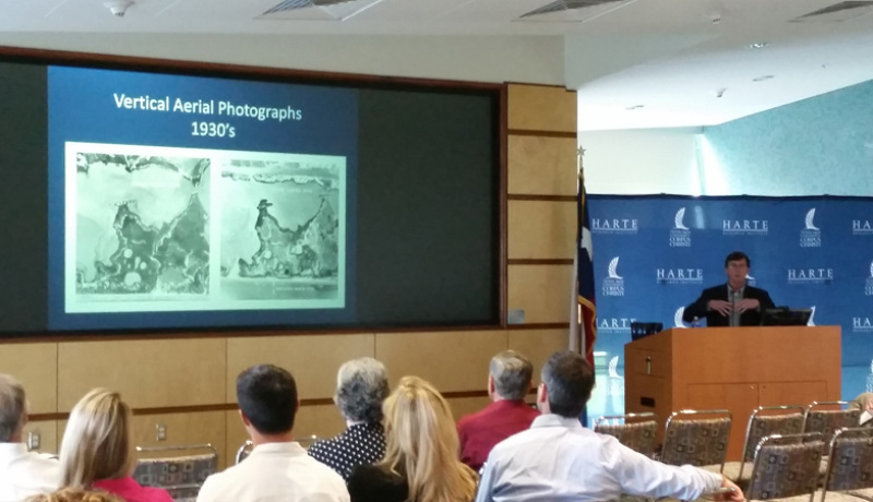
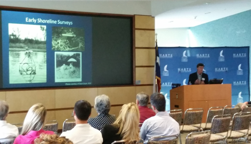
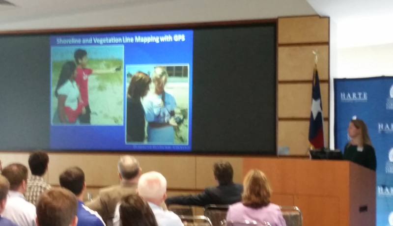
The Texas High School Coastal Monitoring Program (THSCMP) engages students and teachers who live along the Gulf of Mexico in the study of their natural environment. Scientists from the Bureau of Economic Geology (BEG) at The University of Texas at Austin work with middle and high school students and teachers, showing them how to measure topography, map vegetation lines and shorelines with GPS, and observe weather and wave conditions. Scientists, students, and the public gain a better understanding of coastal processes and shoreline change along the Texas coast through this long-term student research program. We emphasize to the students that they are collecting critical scientific data that will help scientists address coastal issues affecting their community and help coastal residents develop a better understanding of the dune and beach dynamics on the Texas coast.
THSCMP provides students with a real-world learning experience outside the classroom walls. The program not only provides hands-on education, but it also provides valuable data for coastal researchers and regulatory and coastal-stewardship agencies. Since THSCMP began in 1997, data collected by the students have been applied by scientists to investigate beach, dune, and vegetation-line recovery following several tropical cyclones including Hurricane Ike in 2008. Student-collected data are used to monitor the effects of nourishment projects on South Padre Island, foredune modification on Mustang Island, and jetty construction on Matagorda Peninsula. All data collected by THSCMP are integrated into past and ongoing coastal research programs at BEG including verifying shoreline positions for long-term shoreline change rate updates. Through these real-world examples of scientific observations, students gain a better understanding of environmental issues affecting their communities.
Lesson Learned from Beneficial Use of Dredged Material in Texas
Georganna Collins, Ecology and Environment, inc,
2 Riverway, Suite 625, Houston, TX 77065
GCollins@ene.com
Coastal restoration involves many aspects of planning, permitting, construction documentation, implementation, monitoring, and follow up reporting. Coastal restoration in Texas addresses shoreline stabilization, marsh and submerged aquatic vegetation restoration, bird island creation, and even stream restoration to protect inflows to the bays and estuaries. This presentation will provide an overview of beneficial use of dredged material in Galveston Bay associated with the Houston Galveston Ship Channel project and lessons learned and the potential to do more coastal restoration using dredged material.
TIDAL MARSH RESTORATION IN SARTWELLE LAKES
Rhonda Gregg, Atkins
2608 Syndor, Galveston, TX 77544
rhonda.gregg@atkinsglobal.com
Paul Jensen, Atkins
6504 Bridgepoint Parkway, Suite 200, Austin, TX 78730
Luke Le Bas, Atkins
City Plaza, 445 North Blvd., Baton Rouge, LA 70805
Mike Rezsutek, Texas Parks and Wildlife Department
J.D. Murphee Wildlife Management Area, Port Arthur, TX
Marcus Michna, Shelmark Engineering
971 Farm Road 571, Dickinson, TX
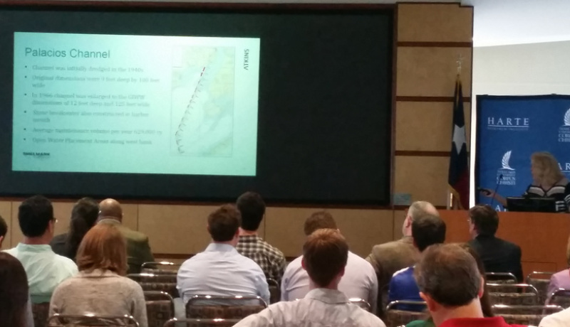
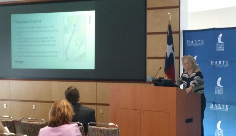
In Phase 1 of the Tres Palacios Study of Beneficial Use of Dredged Material, a Coastal Impact Assistance Program project to identify beneficial uses for material dredged in maintenance of the federal channel to Palacios; it was found that tidal marsh restoration was the most appropriate use for the material. It was also found that there were several candidate sites that were technically viable within reasonable distance from the channel. But because the use of dredged material in tidal marsh restoration along the Texas coast is relatively new, it required over a year of discussions with involved parties before agreement was reached to move forward to the second phase, the design of a project at a specific site.
This presentation will review the process of building consensus on a particular site. A key contributor to the process was the positive experience that Texas Parks and Wildlife had on their marsh restoration work on the J.D. Murphee Wildlife Management Area in 2010. Another positive contribution was the support of Ducks Unlimited in the process. The presentation will conclude with the design itself and the expected beneficial changes in the Sartwelle Lakes
Dredging of the Historical Cedar Bayou Tidal Inlet on the Texas Gulf Coast
Aaron Horine, Coast & Harbor Engineering, A Division of Hatch Mott MacDonald
711 North Carancahua, Suite 909, Corpus Christi, Texas 7840
aaron.horine@hatchmott.com
Josh Carter, Coast & Harbor Engineering, A Division of Hatch Mott MacDonald
650 Poydras St., Ste 2025, New Orleans, LA 7000
Patrick McLaughlin, Coast & Harbor Engineering, A Division of Hatch Mott MacDonald
3410 Far West Blvd.,Suite 210, Austin, Texas 78731:
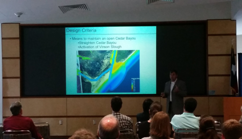
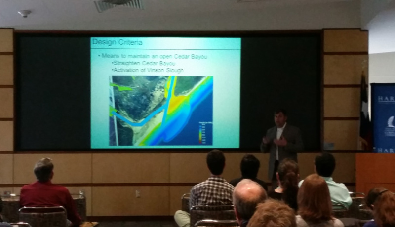
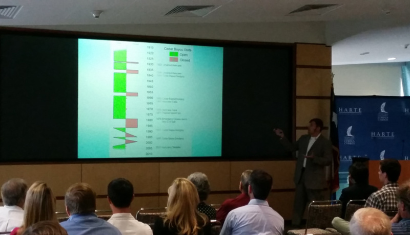
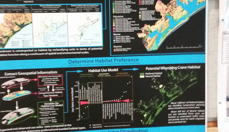
Historically, the Cedar Bayou channel, which separates San Jose Island and Matagorda Island, allowed passage of fish and other marine life between Mesquite Bay and the Gulf of Mexico and provided food sources to a number of coastal inhabitants, including wintering whooping cranes, a critically endangered species. Over the past decade, the channel was completely closed and required opening in order to restore circulation for wildlife and habitat. Dredging and excavation of 550,000 cubic yards was achieved using an intricate combination of mechanical excavation and hydraulic dredging in order to comply with a 6 month environmental window and other conditions set in the permit. Cedar Bayou is classified as an ephemeral tidal inlet which has historically been open and closed depending on environmental forcing and anthropogenic activities. In order to increase the hydraulic stability of the inlet and reduce the time between maintenance dredging efforts, Coast & Harbor Engineering developed a design template connecting Vinson Slough to Cedar Bayou, and Cedar Bayou to the Gulf of Mexico. During dredging and excavation operations, dredged material was transported to one of two beach placement areas southwest of the channel via 10” pipeline and off-road dump trucks. Sequencing of dredging and excavation was critical in order to avoid delays and provide maximum flow upon initial breaching of the dredge template to the Gulf of Mexico.
Conservation measures were implemented to limit impact on whooping cranes, piping plovers, and nesting sea turtles during on-site activities. Mobilization and access for the contractor to service the project were closely monitored by regulatory agencies in order to minimize environmental impacts during transport of equipment, personnel, and fuel to the remote project site. Despite numerous environmental and logistical challenges, Cedar Bayou finished construction without impact to sensitive habitat and ahead of schedule in early October 2014.
Comprehensive 3-dimensional beach monitoring of Galveston Island
Paul Jensen and Dillon Fugate, Atkins
2608 Syndor, Galveston, TX 77544
Tim Dellapenna, Department of Marine Science and Oceanography
Texas A&M – Galveston, Galveston, TX
Joshua Williams and Joseph Carlin, Department of Geological Sciences
University of California – Fullerton, Fullerton, CA
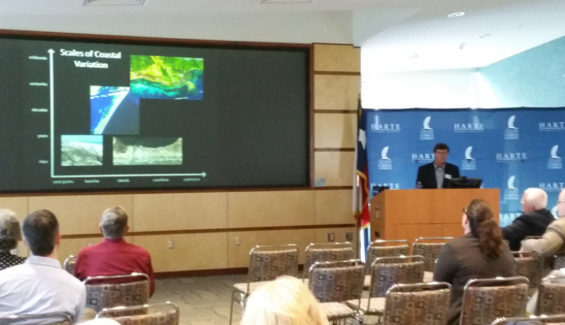
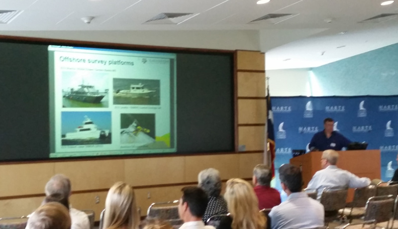
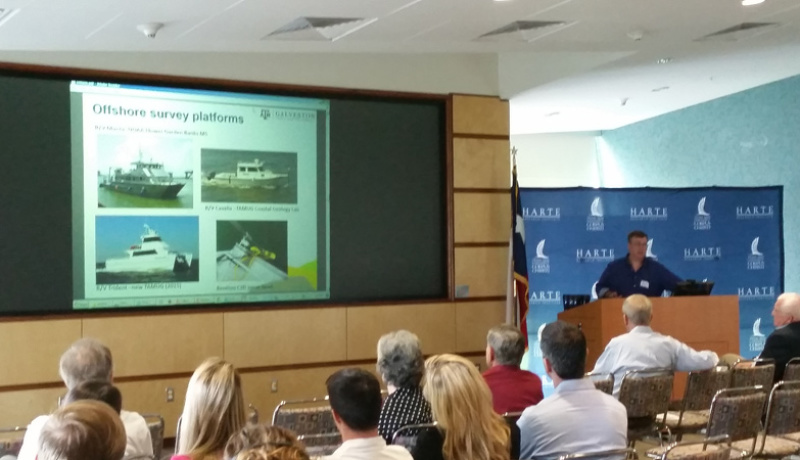
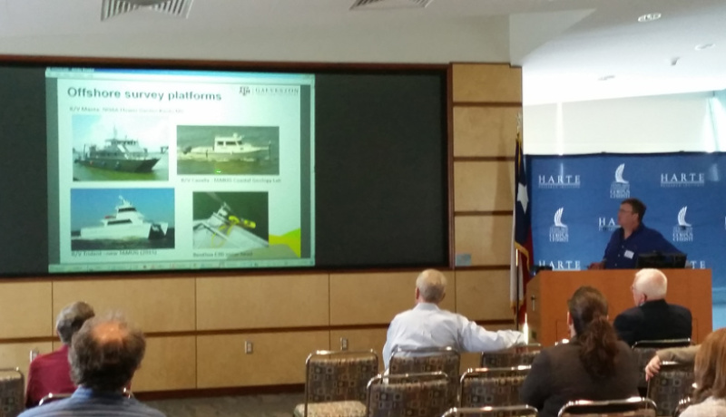
In the spring of 2014, the City of Galveston contracted with Atkins and TAMUG to conduct a comprehensive 3-dimensional (3D) beach-monitoring/surveying program. The first survey was conducted during the summer of 2014, when an exceptional amount of Sargassum was coming ashore. The dry beach was surveyed by Atkins using Leica C-10 Laser Scanners, with the Leica Cyclone software used for processing. The swath bathymetry was conducted by TAMUG, using a Benthos C3D® ultra high-resolution bathymetric sidescan sonar, with a 100 m swath. The dry beach and swath bathymetry data were tied together by Atkins using traditional wading depth beach profiles collected every 304.8 m (1000 ft) across much of the island. The data were merged using a combination of ArcMap and AutoCad Civil 3D 2014. When merged, a Digital Terrain Model (DTM) was generated for the entire length of Galveston Island from the dune line/Seawall out to the 12 m isobath.
The original RFQ called for beach profiles to be collected every 1,000 ft. However, the project team proposed the 3D approach so that beach profiles can be drawn for any location along the island. Dr. Juan Moya, formerly with Atkins, developed the project approach. The project was developed to fulfill the FEMA Public Assistance Program requirement of developing a monitoring plan for Galveston to maintain its certification as an “engineered beach”.
The presentation will provide an aerial overview of the results and discuss some of the advantages of the technical approach. It will also include a discussion of the challenges encountered with the Sargassum during 2014.
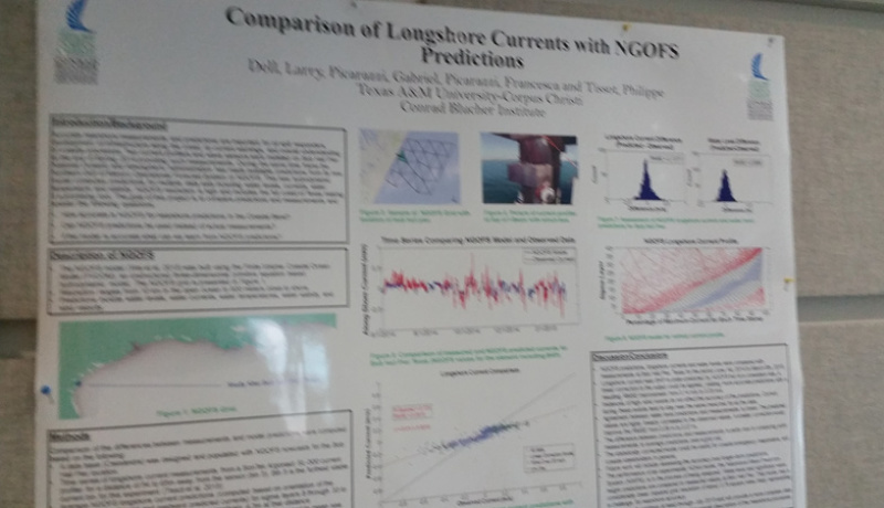
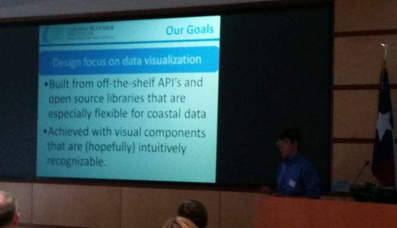
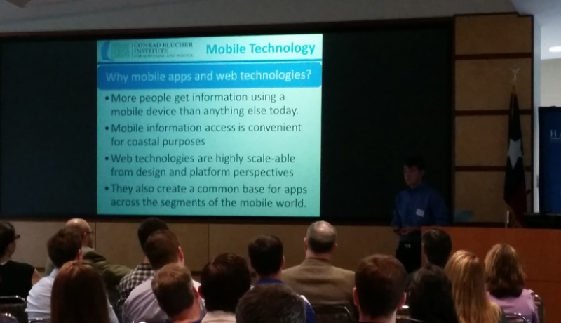
Development of Apps to Access Nearshore Measurements and Predictions Including Longshore Currents
Bradley Koskowich and Philippe Tissot, Conrad Blucher Institute
Texas A&M University-Corpus Christi,Corpus Christi, Tx 78412
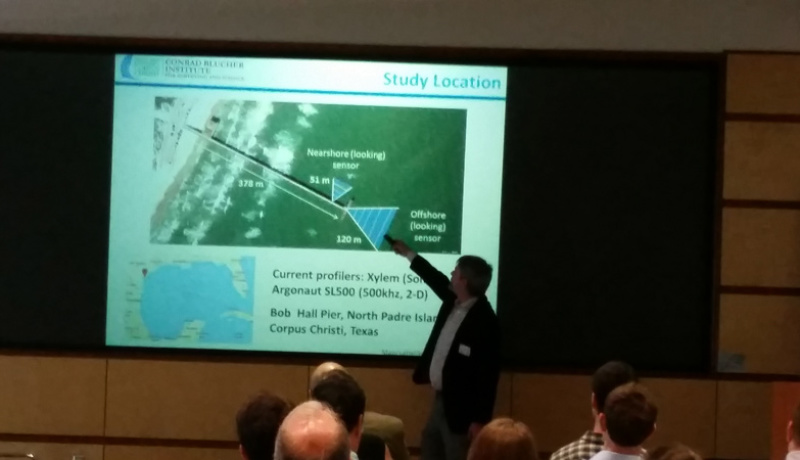
Two current profilers were installed during spring 2014 on Bob Hall Pier, Corpus Christi, Texas. The sensors provide near real-time measurements of nearshore conditions including significant wave height, typical wave period, average along and cross shore currents and current profiles. Additionally the National Oceanic and Atmospheric Administration (NOAA) updated and made available the output of its Northern Gulf of Mexico Operational Forecast System (NGOFS). Output includes high resolution current predictions along the Texas coast. Two sets of apps and web pages were designed and implemented to allow easy and intuitive access to this information. One of the apps is designed for recreational users in the Coastal Bend providing the latest conditions at Bob Hall Pier including current and wave conditions as well as atmospheric measurements from the collocated NWLON stations. The other app is designed for oil spill responders and other operational users along the Texas coast. The latest measured current profiles of the longshore currents at Bob Hall Pier are visualized as well as animations of recent profiles up to five days. Additionally the app provides NGOFS current predictions for the Texas coast. The apps are developed with standard web development technologies and wrapped into native apps for different devices. Broadly available and accurate current predictions and measurements are invaluable for the prediction of oil movement and the deployment of protection measures in case of oil spill as well model sediment transport along the coast and search and rescue situations.
Virginia Point – Protecting Valuable Galveston Bay Shoreline
Chris Levitz, PE, CFM URS Corporation
19219 Katy Freeway, Suite 100, Houston, TX 77094
Chris.Levitz@URS.com
The Virginia Point Peninsula Preserve is owned and maintained by locally based nonprofit group Scenic Galveston, Inc. The 3,000-acre prairie preserve is bordered to the south and east by over10,000 feet of shoreline along Galveston Bay, much of which suffers from rapid erosion at anestimated rate of 7 to 10 feet per year. As a result, Scenic Galveston has spent years working toidentify a way to curtail this erosion and preserve the shoreline.This process has evolved from a concept to final design, with many steps in between led by thepassionate group at Scenic Galveston in coordination with the Texas General Land Officethrough multiple grants. The final design includes over 6,000 feet of natural stone breakwaterthat is to be constructed in a manner that will not only protect the existing shoreline from theerosive wave action generated within Galveston Bay, but also includes unique features that willenhance other aspects of the bay system. The placement and spacing of the breakwaters wasdesigned in a manner to promote shoaling behind the breakwaters in several large cells for futuremarsh development. An undulating breakwater crest is also included to promote nesting, particularly for local Oystercatchers. The project is expected to go into the construction phase in2015, bringing much needed relief for the fragile shoreline.
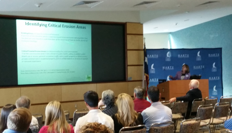
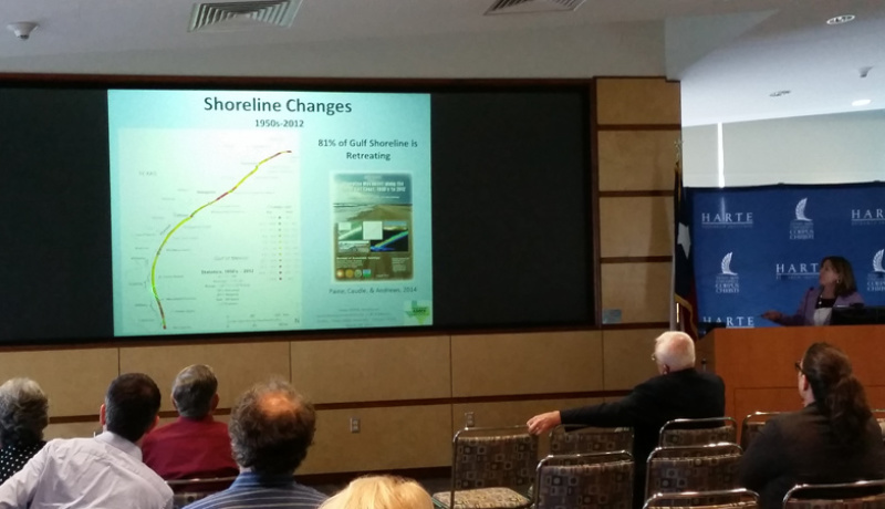
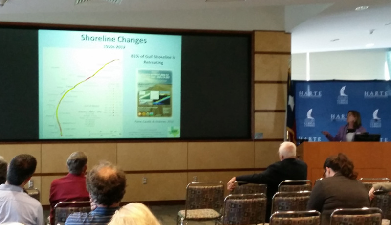
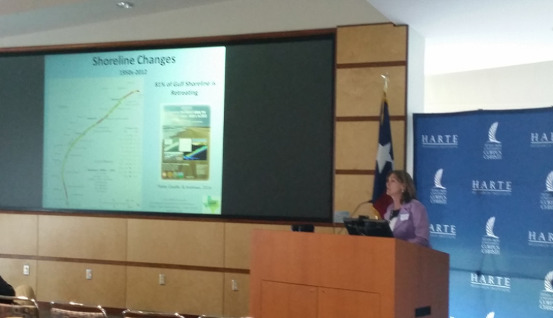
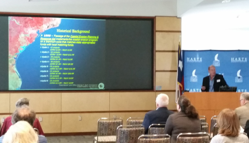
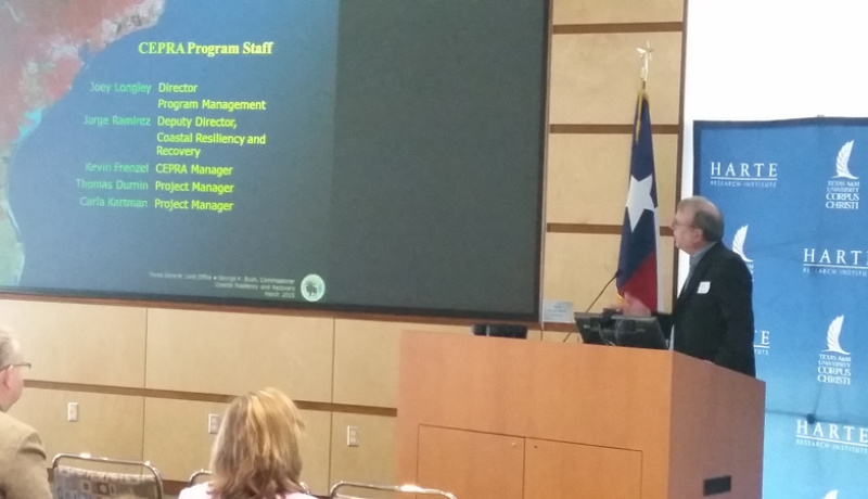
TEXAS COASTWIDE EROSION RESPONSE PLAN: 2013 UPDATE
Kimberly K. McKenna
P.O. Box 9586, Newark, DE
k.k.mckenna@comcast.net
Kevin Frenzel, Texas General Land Office, Coastal Resources
1700 N. Congress Ave., Austin, TX
The Texas Coastwide Erosion Response Plan 2013 Update provides a summary of the latest shoreline change results published by the Bureau of Economic Geology at the University of Texas at Austin and a review of the Texas General Land Office programs that manage or impact erosion. Coastal erosion remains a continuing threat to the Texas Gulf and bay shorelines. Whether the erosion is caused by the lack of sediments to balance the long-term losses within the coastal compartments, or the episodic erosion brought on by storms or human activities, planning and implementation of erosion response and sediment management practices is essential to the sustainability of the shoreline and public beaches.
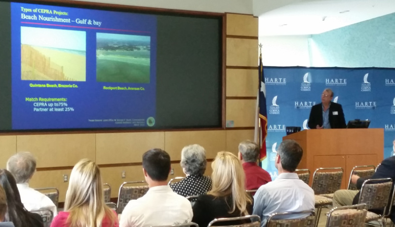
With limited funding and economical sand resources, the state of Texas continues its battle against shoreline erosion. The 2013 Update presents a review of the Coastal Erosion Planning and Response Act (CEPRA) program Cycles VI and VII projects, beach recovery following Hurricane Ike, the fallout from the Supreme Court of Texas Severance opinion on the CEPRA program and public beach access and use, and the local planning efforts by the Gulf communities.
Beach nourishment, studies/monitoring, and shoreline protection were the most common categories that were funded during Cycles VI and VII. Most of the projects were concentrated on the upper Texas coast that is still reeling from the erosional impacts from Hurricane Ike (September 2008). Coastal Bend and lower coast projects tended to focus on marsh/habitat restoration near Corpus Christi and beach nourishment along South Padre Island.
Bionic West Bay…We can rebuild her
Ronny McPherson, HDR Engineering Inc.
555 N. Carancahua, Suite 1600
Corpus Christi, TX 78401
RONALD.MCPHERSON@HDRINC.COM
Michael Weeks, Texas General Land Office
1700 N. Congress Ave, Austin, TX 78701
Cherie O’Brien, Texas Parks & Wildlife Department
1502 FM 517, Dickinson, Texas 77539
A number of cooperative and complimentary marsh restoration efforts have been completed and/or are underway in Galveston West Bay. These projects help to offset lack of natural sediment accretion and combat marsh fragmentation resulting from wave-induced erosion and drowning due to relative sea level rise (RSLR). Restoration of estuarine habitat requires identification of fill material suitable for habitat restoration, sediment analysis, quantification of immediate (elastic) and long-term (consolidation) settlements, and establishment of fill elevations that will support the targeted vegetation species. Most of the projects constructed in West Bay have consisted of relatively thin-layer placement of fine sand dredged from the native bay bottom to create broad, gently-sloping emergent mounds. The mounds are designed to target the high range of intertidal marsh elevations to accommodate future RSLR and provide longer life. Since 2001, mounds constructed in both open water and within existing fragmented marsh complex have been shown to be a successful, cost-effective restoration strategy.
The most recently constructed project marsh restoration project in West Bay is located at Bird Island Cove. In addition to constructing mounds for habitat, this project included a geotextile tube breakwater to protect exposed existing marsh. The project was managed and funded through a partnership with the Texas General Land Office and Texas Parks and Wildlife. Overall a total of 70 acres of marsh were created and/or protected through the project. The presentation will provide a brief overview of the restoration efforts performed to date in West Bay, a summary of the Bird Island Cove marsh design and construction, and provide some lessons learned on project performance and construction aspects.
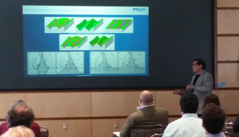
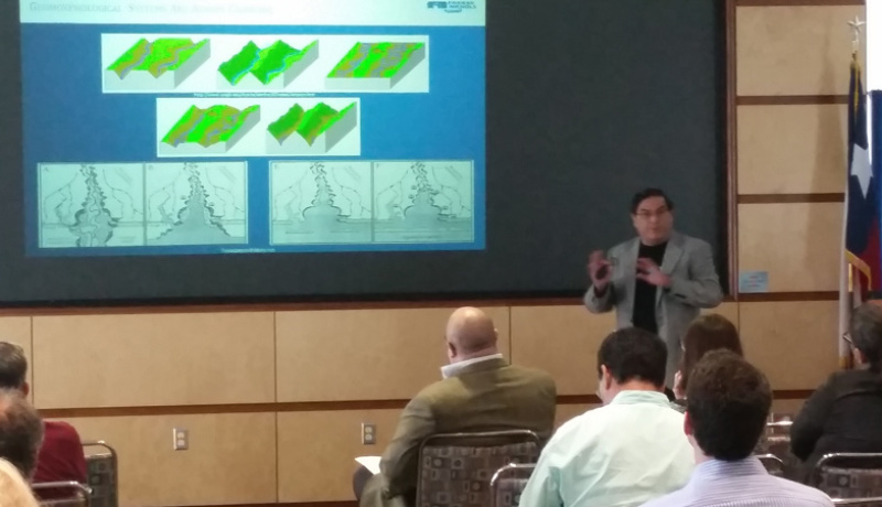
Coastal Geomorphological Resilience: Morphodynamic Concepts that Apply to Texas Coastal Protection and Restoration Initiatives
Juan Moya, Cris Weber, Tom Dixon and Dave Buzan
Coastal Planning and Restoration Group
Freese and Nichols, Inc.
10431 Morado Circle, S300., Austin TX 78759
Juan.moya@freese.com
Since the establishment of geomorphology as a science, geomorphologists have interpreted landscape evolution using concepts of “Morphodynamic Adjustments” and “Natural Resilience.” Landscape resilience processes can be observed in the geologic record and dated. In recent times, the concept of coastal community resilience (CCR) is discussed synonymously with vulnerability. For instance, in coastal geomorphology (CG), “vulnerability is the degree to which a coast is likely to be affected by, or its incapability to withstand, the consequences of impact” (Woodroffe, 2007). Areas where fast geomorphologic processes are presently and obviously still occurring are now called “vulnerable” from the community perspective and are the focus of new federal policies. Radiocarbon dating collected during Texas coastal geomorphologic studies demonstrate temporal development and changes of our coastal ecosystems and landforms, and how they were resilient (or not resilient) to relative sea level rise (RSLR). The radiocarbon data pertains to river delta migrations, bay inundations, barrier island creation, and oyster reefs and marsh creation, all of which are the focus of present-day restoration goals. These geologic records show that for the last 7,000 years, Texas coastal eco-geomorphologic units were forced to change from a fluvial to a coastal dominated environment, where RSLR forced our coastal systems to coalesce into new geomorphologic, ecologic and sedimentary regimes (Anderson, 2007; Blum et al., 2013). This presentation compares the concepts used recently for CCR (both at regional or local scales) and offers a connection with the concepts used for long-term and short-term coastal morphodynamic changes.
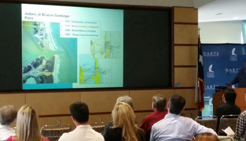
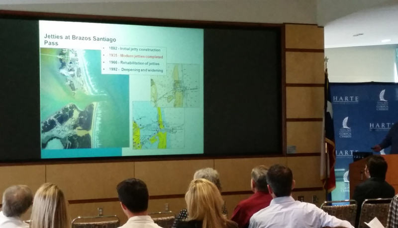
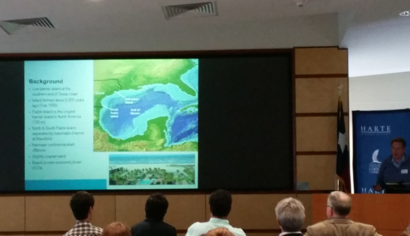
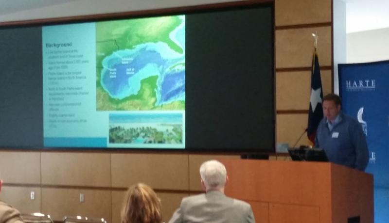
Beneficial Use of Dredged Material at South Padre Island, Texas, an Economic, Environmental, and Partnership Success Story
Ray Newby, Texas General Land Office
P.O. Box 12873, Austin, TX 78711
ray.newby@glo.state.tx.us
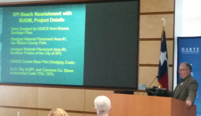
The South Padre Island (SPI) Beneficial Use of Dredged Material (BUDM) Project is a successful effort between the City of South Padre Island (City of SPI), the Texas General Land Office (GLO), Cameron County, and the U.S. Army Corps of Engineers (Corps) to address chronic shoreline erosion by using a valuable resource formerly referred to as “spoil.”
The project is located on 4,000 feet of Gulf shoreline of SPI. The project uses sand dredged from Brazos-Santiago Pass by the Corps during dredging of the Brownsville Ship Channel that would otherwise be placed offshore and out of the littoral system. Beach nourishment activities occur between October and March to allow work to be performed outside of sea turtle nesting season and tourist season. Annual surveys are conducted to monitor the beach conditions.
The project has been conducted nine times since 1997. GLO Coastal Erosion Program funds have been used with City of SPI and County funds to pay the incremental cost required by the Corps. In 2001, the Corps and GLO established a BUDM agreement to streamline the contracting process for the SPI project and similar projects in Texas.
This project highlights the advantages of BUDM to restore eroding beaches. State and local entities get sand on the beach at a much reduced cost to mitigate historic erosion and enhance habitat for endangered sea turtles. Economic analysis of the SPI BUDM project indicates that the project provides a benefit cost ratio in excess of 9 to1.